More than half of the world’s population is living in cities. According to the WHO air quality database, 80% of people living in urban areas that monitor air pollution are exposed to air quality levels that exceed WHO limits. Narrowing down to cities in low- and middle-income countries with more than 100 000 inhabitants, this number increases to 98%. To revert urban air pollution a clear understanding of the local situation is essential. Low-income cities, which are most impacted by unhealthy air, usually have less resources available for a good reference network. It is here where a combination of low-cost sensors and satellite data can make a difference.
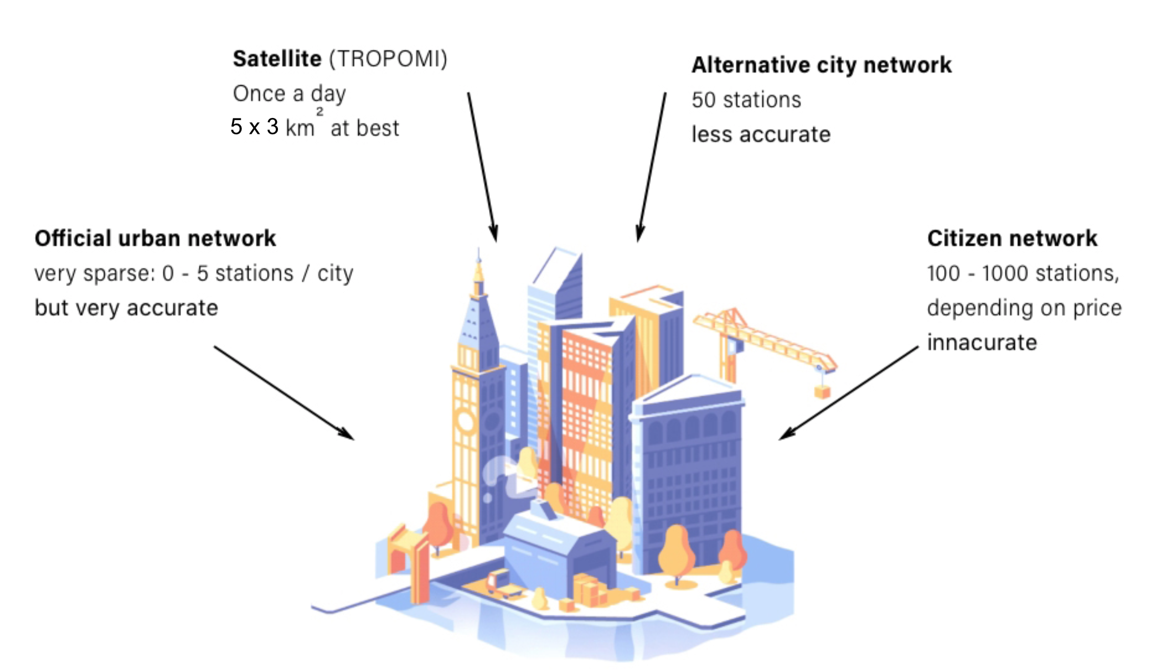
Integration of different data sources of air quality observations is far from trivial. Observations about air quality are available from a wide variety of data sources (see figure), however they all have different sampling coverage and frequencies as well as different spatial representativities. Low-cost air quality sensors have emerged over recent years and provide a possibility for acquiring air quality observations at high spatial detail in urban areas, however they often suffer from substantial uncertainties. Satellites observe air pollution in the troposphere, and its relation with surface concentrations must first be solved for urban air quality monitoring applications. So far, only very few studies aim at joining heterogeneous data sources of urban air quality, and to our knowledge no previous work has provided practical solutions which can be implemented in cities everywhere.
CitySatAir investigates how satellite data can be better exploited for monitoring and mapping of urban air quality at scales relevant for human exposure.
For this project, we gather data from:
- Sentinel-5P/TROPOMI
- Reference monitoring stations
- Low-cost sensor networks
By help of data assimilation, we develop a functional prototype for urban air quality, which then is tested, validated and evaluated. The end goal is to deliver satellite-assisted hourly AQ maps of NO2 at 100 m resolution. Innovative elements of this project include a) Applying satellite observations for air pollution at surface-level, b) Unifying heterogenous air pollution data, c) Correcting underlying emissions, d) Versatile application to other urban areas.